Sunday, November 3, 2013

Utah Cliffs Loop - Day 4

After a windy night of not much sleep I reviewed my status and options. I could continue riding and trying to complete the loop, but the odds were against me. By now I realized that the high altitude and serious amount of climbing had set me back enough on my daily mileage that completing the loop on time was getting difficult if not impossible. In addition I had my bended rear derailleur. After some fumbling around it seemed to be working fine, but did not give me a warm and fuzzy feeling. From here on there were no short cuts or "Hey can you come and pick me up".
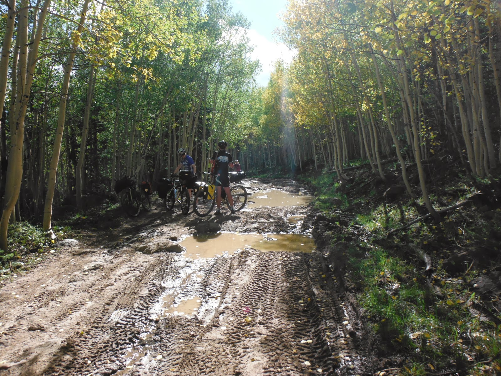
I settled for riding back to Cedar City via Cedar Breaks Memorial Park. This would add some more climbing and maybe satisfy my "Biked at > 10,000 ft altitude goal". In addition Harry told me that Cedar Breaks Memorial was supposed to be beautiful.


Autumn Colours at Hancock Peak

Highest Altitude of my trip 10,493 ft
On my way to Cedar Breaks I enjoyed beautiful fall-coloured views of Hancock Peak. The morning was cold and I was happy that I put on my leg/arm warmers and a wind-tight jacket. The climbing continued and after 7 miles I reached my peak altitude of 10,493 ft.

Entering Cedar Breaks Memorial Park

First Overlook at Chessmen Ridge


Harry was right. The views from Chessmen Ridge and Sunset View Overlook were magnificent. They made the climbing, cold and lack of oxygen worth while.


Second Overlook at Sunset View


At Sunset View an older couple was getting out of their car as I walked back to my bicycle. As I was mounting my bicycle they were rubbing their eyes as if they saw a ghost. "Did you really bike up here?!". I had a good laugh about it and told them next time I would rather take the car.
Now it was time to descent whatever I ascended the day before! The previous day the 18 mile stretch to this very point took me over 3 hours. Today it took me less then a hour to get back down where we started.

Baurn-platte at the Wunder-bar restaurant.
These bottles look better with some Utah dirt on them!
Did have to stop half-way to shed some clothes and tune my breaks a bit. The long downhill had worn down my brake-pads enough that my brake levers were now touching my bars.
I arrival in Cedar City around lunch-time and found this pace where they served some German food. I treated myself to a farmers plate and a large soda.
After lunch I called an old colleague in St George and asked if he could give me a ride back to St George. He was happy to do me the favour and a few hours later I was back at my hotel in St George.


Miles: 31.1
Total Descent: 4,987 ft
Highest Altitude: 10,556 ft.


See Garmin Connect Map for details.
More pictures of first day can be found here: Drop-box link Day 4


Sunday, October 13, 2013

Utah Cliffs Loop - Day 3

The night was terrible. I almost did not get any sleep at all. The tent site was a few yards from main street and cars and trucks kept driving by all night long. At 5 AM in the morning I gave up trying to get to sleep. I went to the bathrooms for an early shave and back at the tent I started making some coffee to get a start into my morning.
Breakfast at the Main Street Grill

I took my time for breaking down the tent and packing my bike. At 8:30 AM we met with the others of the group for breakfast at the main street grill.

Around 9-ish we paid for our breakfast and started our ride. First we back-tracked for about a mile and then turn left to start one of the longest climbs; 18.5 miles of climbing at an average of ~8%. We stopped briefly at the bottom of the climb and agreed to re-group at mile 5. There we would agree upon the next re-group point depending on the progress.

First re-group at mile 5.
The first 5 miles were not to bad. The average climbing was ~3%, but from here on it would get steeper. The local bike shop owner had warned us: "The climb is not to bad.....but the altitude will kill ya!" After a short re-group we selected the next stop and paced ourselves slowly up the hill.

Getting steeper!

Confirmation sign of the 8% grade
The grade definitely was becoming steeper, and the air was noticeable getting thinner due to the altitude. I regularly had to stop to catch my breath.

Bob again in the left corner  ;o)
As we kept climbing I would combine catching breath with taking pictures; you can find them via the link at the bottom of this post. Also here you will find Bob again in the corner of my pictures..LOL

Mountain Center of Utah University.

Waiting the the others to re-group.
The 2nd re-group point was at the Mountain Center of the University of Utah. We were lucky. The center has a water spigot and a rest-room. The caretaker allowed us to use both of them even though they were not for public use.


Beautiful scenery during the climb.
3rd regroup at Webster Flat.


Getting out of the wind for lunch.
At Webster Flat the steep grade was combine with a teribble head wind. We waited to re-group and had lunch between a group of trees that provided protection from the wind.

Tree with eyes?!?
After some dried fruit, turkey, and a bar I enjoyed the beauty of trees with a funky white bark. Somehow I had the feeling they were watching us....

Made it to the top!

Highest altitude for day 3; 9854 ft
Finally after a solid 3 hours of climbing we made it to the top! I was a bit disappointed to not see 10,000 feet on my GPS, not knowing that my wish would become true the very next day.
After a few miles on the road we would take a left onto gravel roads in the direction of Hatch. Target for the day would be the 2nd dispersed camp-site next to Mammoth Creek. But first we had some gravel grinding to do to get there!


Autumn kicking in...

Some "technical" down-hills with lots of boulders.
At this altitude autumn was kicking in and leaves were dropping and changing colours.We hit the section where the rout-slip stated "Road gets rough and begins descending. You may need to walk parts of this section". I think that all of us were used to do technical rides, and no walking was required. I remember being fully focused on the trail ahead and continuously setting out a path in my mind and renegotiate that when balance was lost. 

Muddy sections.
The technical descents where topped off with some muddy sections. On one of those sections my rear derailleur hit on a rock, stopped the bike, lost my balance and ended up with some bruises, a cut, muddy feet, and a dent in my pride for not falling on the difficult sections.

Forests and meadows.
After getting on my feet and on the bike again my rear derailleur started miss-shifting. I choose a gear that was stable and would take a closer look at it at the camp-site.

Camping at Mammoth Creek
A few miles later we arrived at the targeted dispersed camp-site. Everybody claimed there spot and set-up camp. I cleaned my muddy feet and leg in the creek and licked my wounds ;o)


Beautiful sunset in the west.
Moon rise in the east.
I was able to adjust my rear deraileur for the miss-shifting. While it now was shifting fine, it was unclear what happened and it did not give me a warm and fuzzy feeling. It would have to do for now. I was hungry and needed some food. Pasta with cooked (to soften) teriyaki beef jerky is what the doctor ordered!
After dinner we had a beautiful sun-set in the West while getting a rising full moon in the East.
A beautiful end of an epic day!

Miles: 30.5
Total Ascent: 4,908 ft
Highest Altitude: 9,854 ft.


See Garmin Connect Map for details.
More pictures of first day can be found here: Drop-box link Day 3

Thursday, September 26, 2013

Utah Cliffs Loop - Day 2

I got up early around 6:30 AM and had some hot cereal with for breakfast. Packed my gear, filled up my water bottles and was rolling at 8 AM.

Spork in action.


By the way. After I got home and paid more attention to my pictures I noticed in many of them the presence of "Bob"; the flag of my Bob-yak trailer. During the day I would shoot pictures and not see any details because of the glare on the display of my camera. So moving forward...look for Bob!

View back to Pine Valley with "Bob" in the left corner ;o)

First I had to bike back ~4 miles to get to the right turn to the gravel road that would bring me to Pinto via a nice valley with a small lake and grazing cows all over the place.

Valley with small lake.

120 degrees panorama shot.

Regularly I would turn a corner and cows would be standing on the narrow road staring at me not knowing what to do. In most cases I would slowly pass them. In some cases they would run off for 100's of yards, not knowing what to do and finally stop, or run of the road.

Oh ooh...

As I arrived in Pinto I ran into this surprise: "Public Notice: Page Ranch Bridge Replacement project. Aug. 19th to Oct. 17th 2013. Road will be closed. Bridge will be removed making road impassable".
Now I had a decision to make...gamble that I could still carry my bike and gear over whatever the bridge crossed, or take a long detour. Since I had seen fresh bicycle tracks on the road (assumed the group from the previous day) I decided to keep going. If the road was really impassable, then I would run into those very same cyclist if they had to turn around. A few miles further I found out that the bridge just crossed a big ditch that could be crossed even on the bike.

Miles of gravel road.

Old wagon.
From here on I would ride miles and miles of gravel road with here and there some artefacts like an old abandoned wagon.

Impact of heavy rain.

In some spots you would see the impact of the thunderstorms from previous  weeks.  Visible...but not to bad.

Post office in Harmony.
After many miles downhill I finally arrived on paved road again. This time in New Harmony. New Harmony has one of the tiniest post-office's I have ever seen before. This building used to be a store and had been moved from another location.

Straight towards the I-15 viewing Zion.
From New Harmony it went straight to the I-15 viewing Zion. Just before going under the I-15 is a gas station. They has a store and a sandwich bar. Outside I ran into the other group of cyclist again from the previous day. We talked and they offered for me to tag along if I wanted. I really like that idea, so I did.

From the gas station we continued on paved road for a few miles and then turned right onto a steep unpaved climb. This was one of the few moments I wished I had a triple crank...but I made it!

Mountain Trike @ LBS in Cedar City.
In Cedar city we stopped at a bike shop to buy a few spare tubes for the group while I bought a new water bottle to replace one that started leaking.
Turned out they buld there own MTB-Trike line. Some even with a 4 Hp engine!

Vicky, Harry and myself went to the KOA camp-site on Main street, while the others opted for an expensive hotel. In hindsight that would not have been a bad idea, but I'll explain that on the blog of day 3.

The KOA camp-site was clean. Nice spot for the tents, outlets for charging the phones, hot water in the showers and a laundry to wash our clothes.
For dinner we had pizza and a couple of beers. On the way back we shopped for food for the next 2 days and went off to bed!

Miles: 57.9
Total Ascent: 3,589 ft
Highest Altitude: 6,790 ft.


See Garmin Connect Map for details.
More pictures of first day can be found here: Drop-box link Day 2

Sunday, September 22, 2013

Utah Cliffs Loop - Day 1

I woke up at 6 AM, and had breakfast at the hotel. I loaded all items that would not join me on the tour in my car and parked it in the far corner of the parking-lot (Quality Inn management allowed me to keep my car parked for the week).
After filling all 5 bottles with water, hooking up my trailer to the bike, I took a deep breath and started riding at 8 AM.
The first section would lead me from the outskirts of St George to Snow Canyon State Park.

Snow Canyon State Park Entrance

While biking up to the entrance I met another cyclist on a MTB who told me that he had the exact same set-up (Sala Vaya, Bob-yak trailer and Ortleib handle-bar bag) for cycle touring. Only his bike was one year older and had a different colour. "What are the odds?" he said.
At the Park-entrance I had to pay a $4 "passing fee". I found out later that you can pass with 4-5 cyclist at once for $4; representing a car with passengers.

Snow Canyon bike path

Snow Canyon State Park has well maintained paved bike-paths, clean rest-rooms and a very nice camp-ground. If I had to do the ride again, I would start more south-east from St George and plan my first overnight in this location.

Snow Canyon beautiful views
The bike path kept meandering through the park while climbing moderate to steep up-hill to the exit of the park. There I took a left turn in direction of Veyo.
While the climbing continued I ran into 3 other cyclist (Philip, Jim and Vicky) that were touring the same route. I later found out that they all belonged to a bigger group that got spread out a bit due to different climbing paces.

Short break in Veyo
I planned a break in Veyo and was hoping to replenish my fluids with some cold Gatorade at the local gas station that had a Food Mart. Unfortunately almost everything is closed on Sunday in Utah (including this Food Mart) so I had to stick to my water from St George. In Veyo I ran into 2 other cyclist (Andrew and Susan) from the previous mentioned group. We exchanged some chit-chat and I continued my climb up to Baker Reservoir.

Gravel road East from Baker Reservoir
At Baker Reservoir I experienced my first off-road section of the Utah Cliffs loop. Just like 90% of all the off-road sections it consists of a well maintained gravel road...except if they just has flash-floods and added an addition layer of soft gravel to resolve muddy conditions. In my case that meant that I had to cycle through this loose gravel while pulling a trailer behind me causing extra drag. I could have stayed on the paved R-18...but then I would have missed out on this nice first off-road experience. Did I mention the loose dogs chasing me while ploughing uphill through the loose gravel?

Entering Dixie National Forest
At Central the gravel road turned into paved again. Here I would take a right turn and continue climbing on the FR-35 in direction of Pine Valley.  Meanwhile I was getting hungry so I explored Central for a moment. I was hoping to find a sandwich shop of some kind, but ended up empty. I did however ran into the 5th member (Harry) of the other touring group who was waiting for the others to catch up. I continued for 15 minutes in the direction of Pine Valley and sat in the shade of the entrance sign, ate a bar and some dried honey coated banana chips.
Climbing continuous up to Pine Valley

After my lunch the climbing continued up to Pine Valley. At this moment it was getting hot, my legs were getting tired and my body was feeling the altitude. At this moment I started getting visions of cold beers and nice dinner; not knowing yet that none of that would solidify (remember...it was Sunday..everything closed).
Pine Valley entrance sign (rock)

Finally at 2 PM'ish I arrived at Pine Valley at 6800 feet of altitude. I had still to ride 5 miles through Pine Valley to get to the camp-site. But the end was in sight!
A Coke vending machine...WOOHOO!!!!
Meanwhile I was getting low on water and getting really thirsty. As I only found closed stores my eye caught a Coke vending machine on the porch of "Utah Heritage Realty". I was happy to pull out a $1 bill (proceeds would go to the Pine Valley Fire-department) and enjoy this cold refreshing Coke...boy that tasted good!
Beautiful camp-site at the Pine Valley Recreational area
10 minutes later I rolled into my camp-site for the night. For $15 I got a clean site with a nice level gravel area for the tent. The site had a fire-ring and a dedicated cooking-stand next to the picnic table. The water was fresh from a  well and highly carbonated. It would start of "white" because of all bubbles and turn out totally clear after a minute.
 
Charging my GPS


Pasta and Tuna was for dinner
While getting settled and cooking my dinner of pasta and tuna I charged up my GPS and phone with my LiPo battery/Solar combination. I reviewed my map while having still daylight, set my plans and went to bed early.

Miles: 43.6 (38.9 from start and 4.7 from hotel to start)
Total Ascent: 5,180 ft
Highest Altitude: 6,800 ft

See Garmin Connect Map for details.
More pictures of first day can be found here: Drop-box link Day 1